
Accurate information is the foundation of good decision-making. Our 3D data acquisition and modelling services provide a detailed digital record of buildings, structures, landforms, and infrastructure, helping clients plan with confidence, reduce uncertainty, and make informed decisions. Using advanced technologies including 3D laser scanning, UAV (drone) mounted LiDAR, USV (unmanned boat) hydrographic survey systems, and specialist modelling software, we capture precise spatial data and transform it into practical information that can be used to visualise existing conditions, identify potential issues early, and work from a reliable source of truth.
3D data acquisition is particularly valuable for complex sites where traditional measurement methods can be slow, difficult, hazardous or incomplete. We’ve used laser scanning to accurately model heritage building complexes and earthquake-damaged buildings, UAV LiDAR to map road corridors and land development sites, and USV surveys to chart the beds of canals and lakes. Our combined 3D capabilities mean we can capture data in all kinds of environments. Whether you need to monitor a dam, verify construction works, measure quarry volumes, map waterways, or create detailed as-built records, we focus on delivering accurate, usable information that helps you manage risk, make better decisions, and achieve successful project outcomes.
3D laser scanning is ideal for capturing existing buildings, structures, and landscapes in incredibly accurate detail. It’s commonly used for as-built documentation, building upgrades, site planning, construction verification, and heritage preservation. If you need to measure a complex or detailed environment, laser scanning is often the best approach.
Yes. Laser scanning is a great tool for capturing the exact shape, detail, and condition of existing structures without physical contact. It’s non-invasive and highly accurate, making it perfect for working with heritage buildings, renovations, or any site where preserving existing features is important.
Absolutely. It provides a precise record of as-built conditions, helping reduce design errors, clashes, and delays. Builders, architects, and engineers can plan more accurately with reliable measurements from day one. Whether it’s a new build, extension, or internal fit-out, laser scanning gives you a solid foundation to work from.
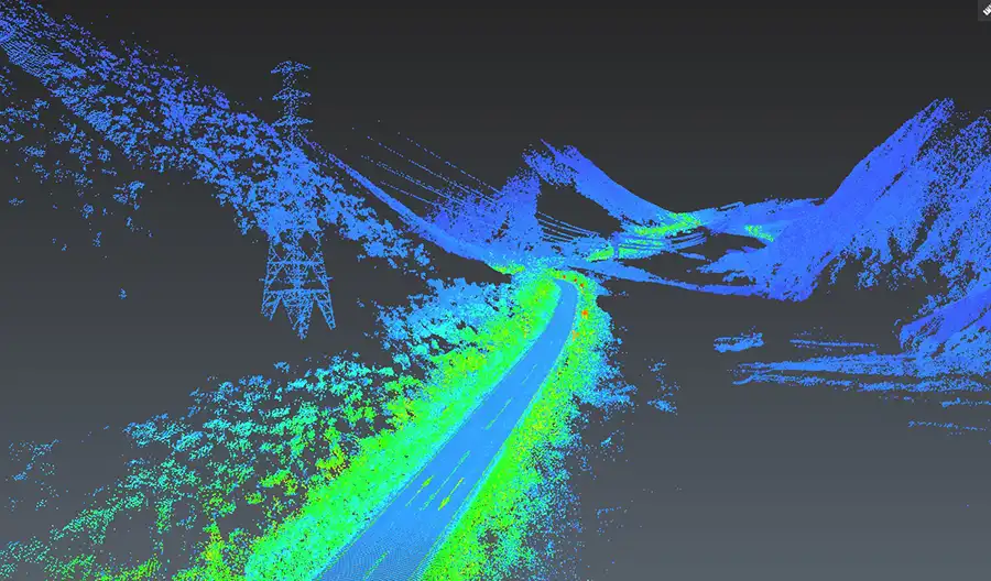
UAV surveying uses Unmanned Aerial Vehicles (drones) equipped with a variety of advanced sensors to capture high-resolution aerial data. It delivers similar accuracy to traditional ground-based surveying, often with more detail and coverage. With the right setup and calibration, UAV surveys can meet or exceed the accuracy requirements for most land development and engineering projects.
UAV surveying is faster, safer, and often more cost-effective. It allows us to capture large or complex areas in a fraction of the time.
You get detailed visuals, accurate data, and a range of outputs such as 3D models, orthophotos, and topographic maps. It’s also ideal for hard-to-reach or hazardous sites like steep slopes, quarries, or active construction zones.
There are multiple options for data collection and processing. There are trade-offs such as collecting data over a wide area quickly at less accuracy or taking longer over a smaller area where you can collect more detailed data at higher precision. Depending on the end use case we match methodology with proper ground control and processing so the UAV surveys can achieve centimetre-level accuracy.
USV surveying uses an Unmanned Surface Vehicle, in our case, either a portable survey catamaran or jetboat, to measure underwater terrain. It’s used for bathymetric and hydrographic surveys in rivers, lakes, ponds, coastal areas, and treatment facilities.
Our USVs capture data using sonar while being controlled from the shore, making it a safe and efficient tool for gathering underwater information.
All of these. Our USV is especially useful in shallow, hard-to-reach, or sensitive environments where launching a standard boat isn’t practical. We commonly use it on lakes, farm dams, treatment ponds, inshore coastal areas, and rivers. If the site is difficult to access or unsafe for people or larger craft, the USV is often the best solution.
USV surveying significantly reduces risk by allowing data collection from the shore. In a lot of cases, there is no need to send people onto or into the water. The catamaran is lightweight and can be deployed by one person, which makes it perfect for tight, shallow, or remote sites. The jetboat is essential for fast flowing water like rivers or canals. For larger or rougher conditions, the sonar gear can be mounted on a manned craft to maintain flexibility.
Absolutely. We provide outputs tailored to your needs, including orthophotos, point clouds, 3D models, 2D drawings, volume calculations, and more. These can be delivered in standard formats that integrate easily with CAD, GIS, or BIM systems. If you’re unsure what you need, our team will guide you through the options.